![]() You can create maps using
the following data sets for any part of the world by connecting to our WWW
- ArcInfo interface page.
You can create maps using
the following data sets for any part of the world by connecting to our WWW
- ArcInfo interface page.
![]() You can also extract profiles
from the grid type data sets using "The Profile Maker"
available in Java applet.
You can also extract profiles
from the grid type data sets using "The Profile Maker"
available in Java applet.
|
|
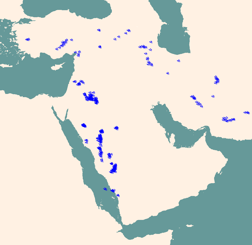
International Seismilogical Centre's earthquake locations (1986 - 1993) |
|
|
Earthquake locations with focal mechanism solutions -- (Harvard CMT solutions) |
|
|
Harvard CMT focal mechanism solutions |
|
|
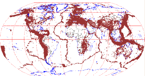
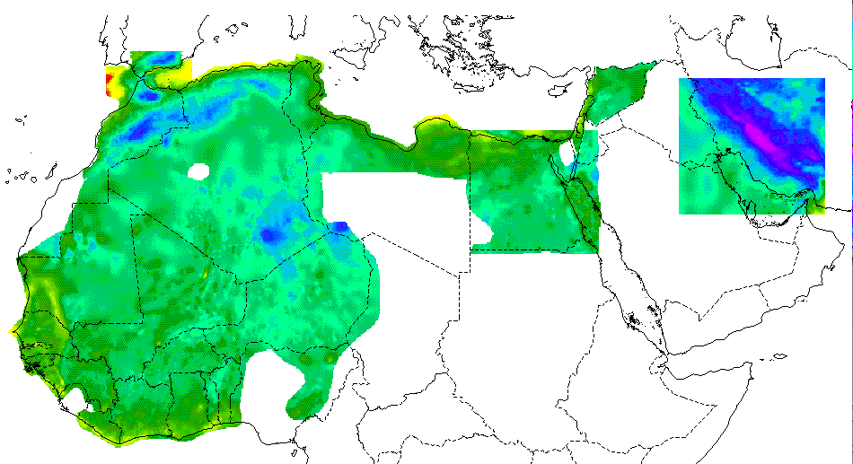
Soviet IPE Moho map of Eurasia |
|
|
Cornell Moho map of Middle East |
|
|
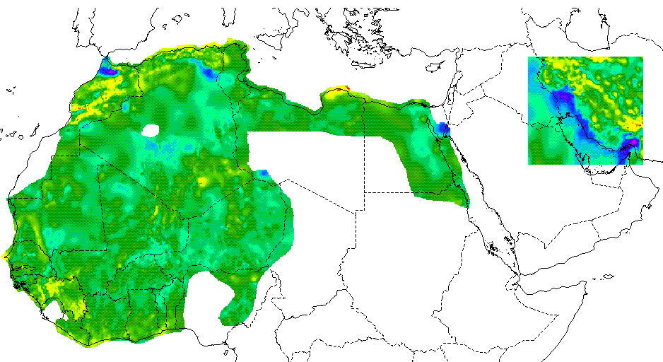
Soviet IPE basement map of Eurasia |
|
|
University of Colorado Moho depth (From Surface Waves) |
|
|
University of Colorado Sediment Thickness (From Surface Waves) |
|
|
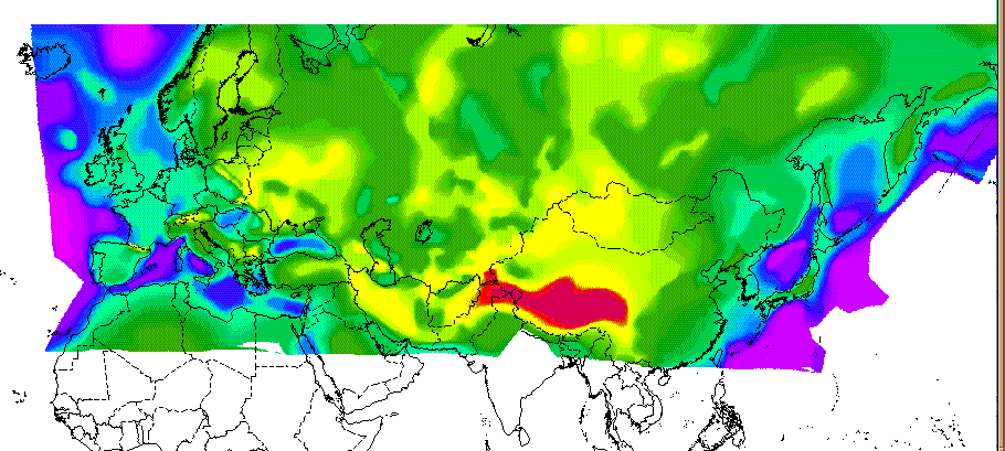
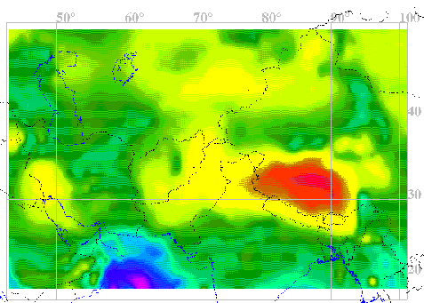
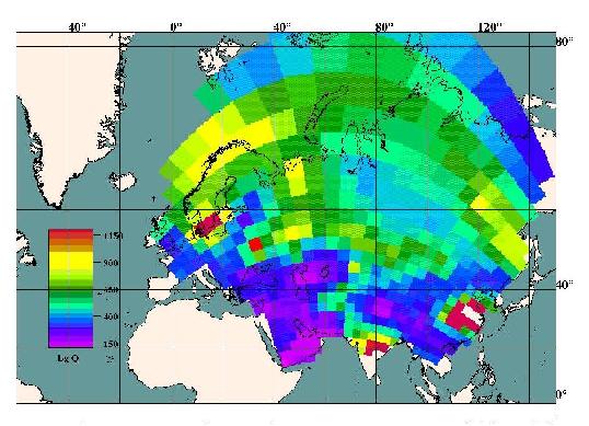
Lg coda Q values of Brian Mitchell of Saint Louis University) |
|
|
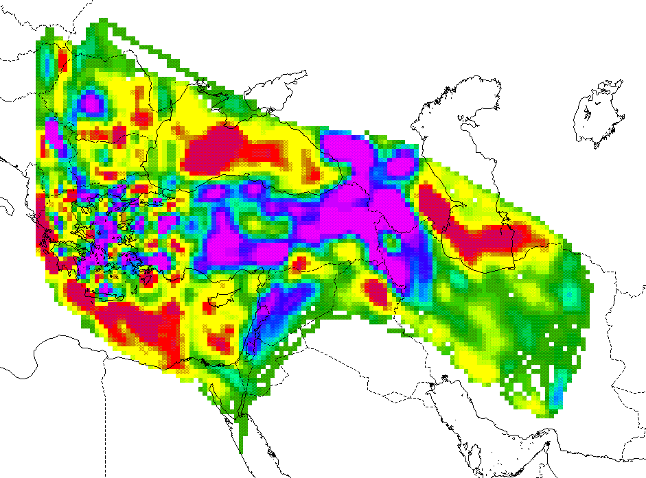
Pn velocity values of Thomas Hearn of New Mexico State University |
|
|
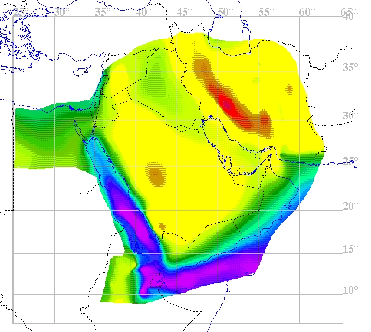
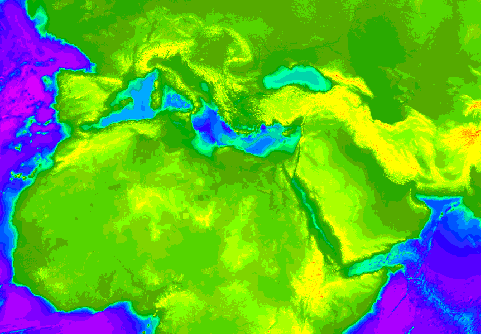
1 km resolution topography of the Middle East and North Africa |
|
|
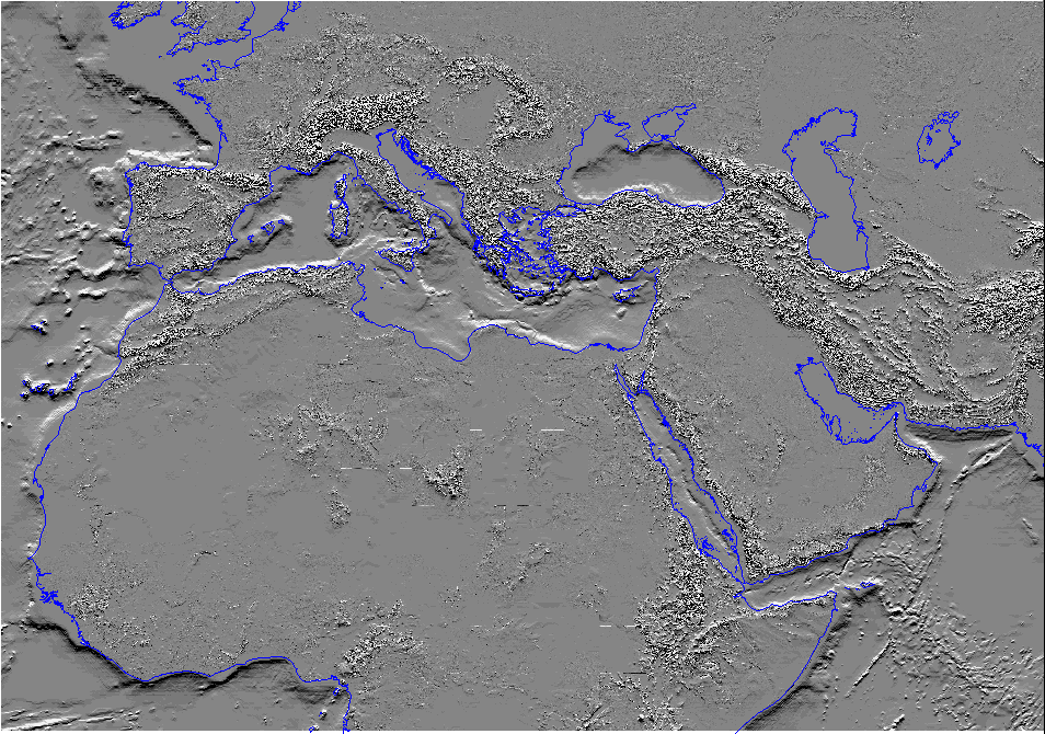
1 km resolution topography of the Middle East and North Africa hill shaded view |
|
|
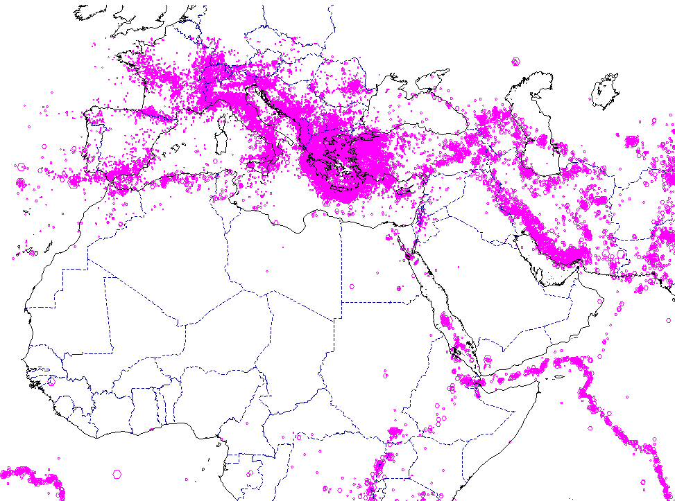
USGS earthquake locations in the MENA 1962-1990. |
|
|
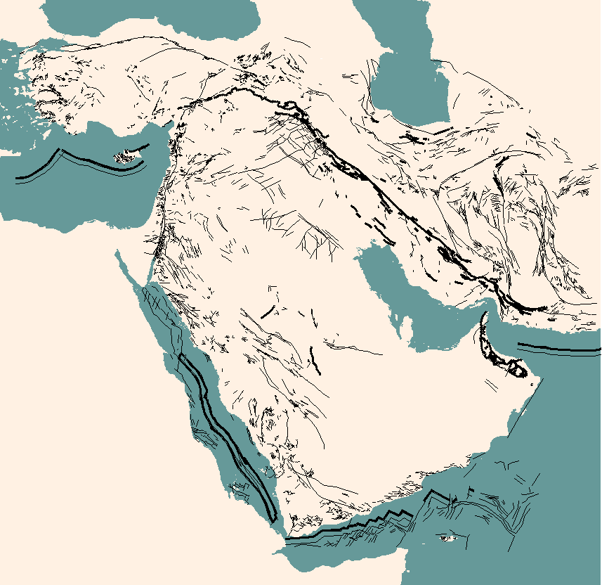
Fault locations in the Middle East |
|
|
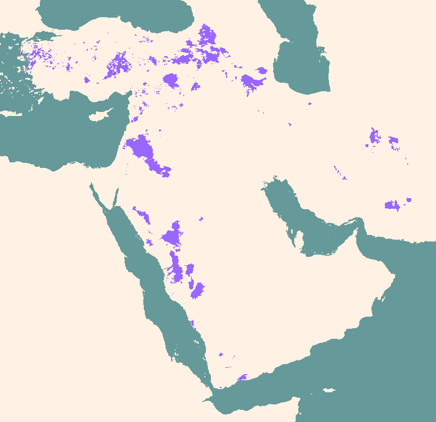
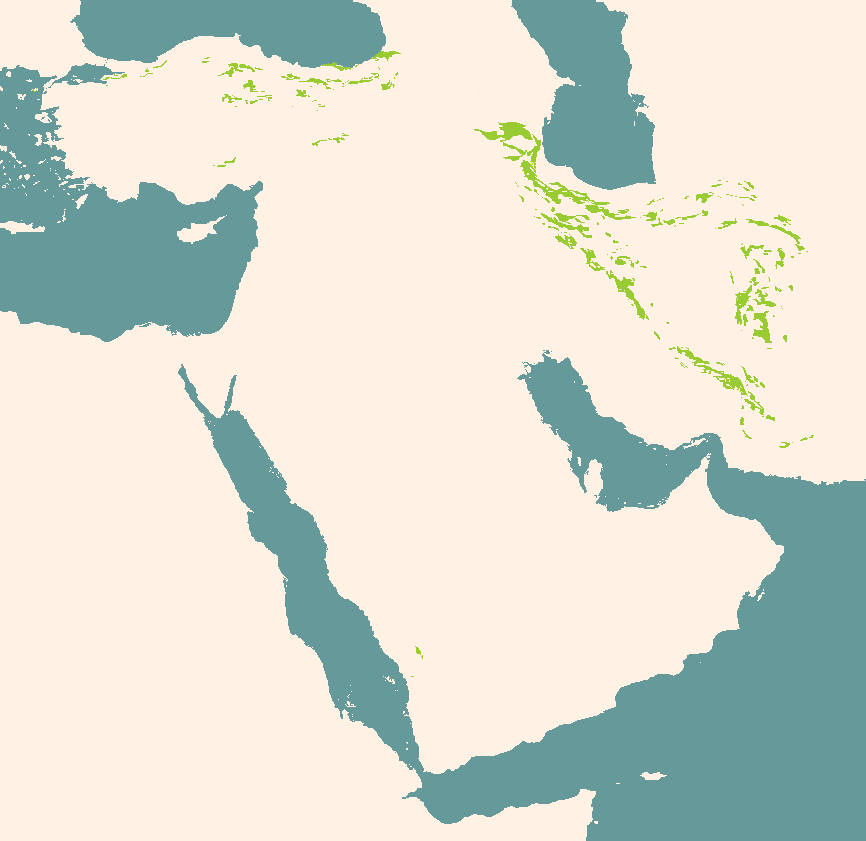
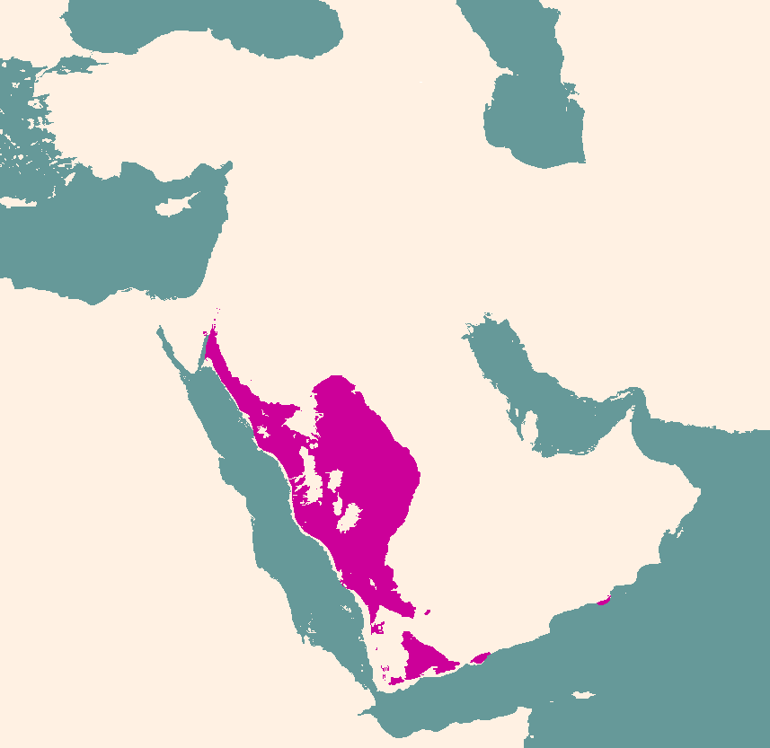
Volcanics in the Middle East (Neogene/Quaternary) |
|
|
Volcanics in the Middle East (Paleogene) |
|
|
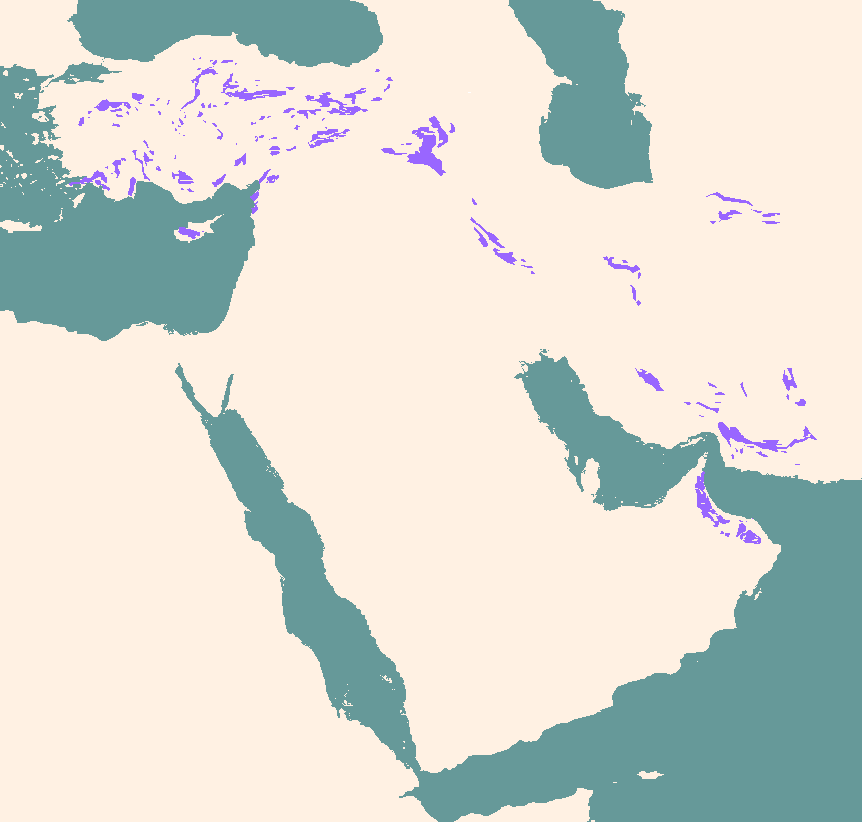
Ophiolite locations in the Middle East |
|
|
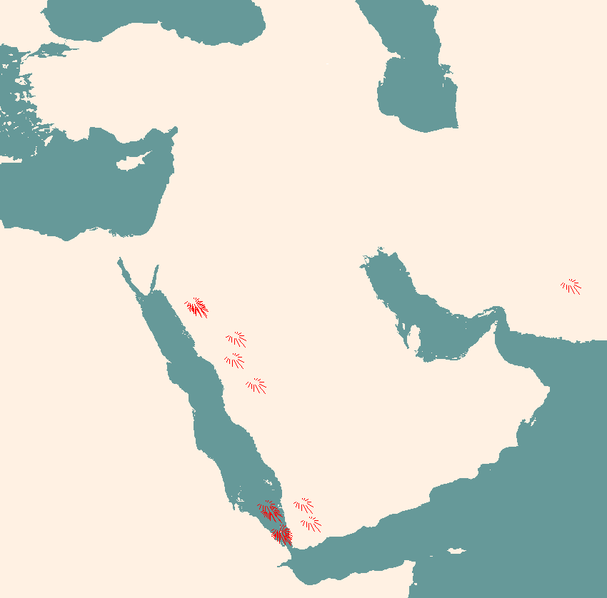
Active volcanoes in the Middle East |
|
|
Extinct volcanoes in the Middle East |
|
|
Basement rock exposures in the Middle East |
|
|
Basement depth countours in the Middle East |
|
|
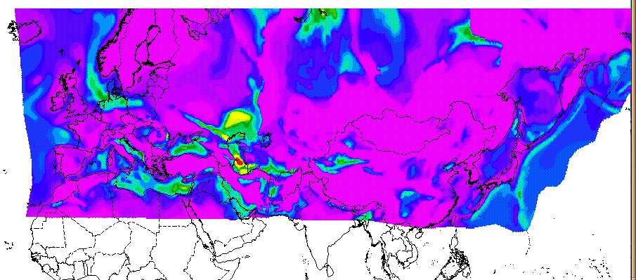
Bouguer gravity map of Africa and Middle East |
|
|
Free Air gravity map of Africa and Middle East |
|
|
Mosaic of five TM Landsat images along the Deas Sea fault system |