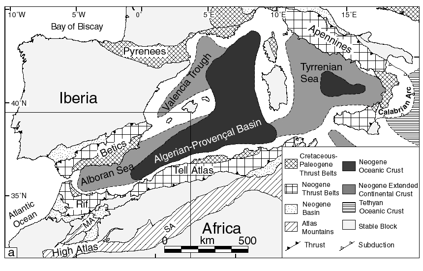
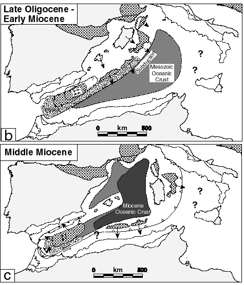
Figure 1.
Maps showing regional setting of the Alboran Sea and schematic paleogeographic reconstructions of western Mediterranean ). (a) The Alboran Sea is one of a number of Neogene extensional basins that formed along the Africa-Eurasia plate boundary zone despite continued convergence between the two plates since the Cretaceous. MA, Middle Atlas; SA, Saharan Atlas. Box shows Alboran region and location of Figure 2. (b) Extension behind a subduction zone retreating to the east and south in the Late Oligocene/Early Miocene resulted in the collapse of a thickened mountain belt that used to extend along the coast of Spain and France. The Paleogene location of the thickened crust that later formed the Betic and Rif Internal zones and the westerly extent of the subduction zone are not well constrained. Arrows show the transport direction. (c) Extension persisted until the Early/Middle Miocene with continued westward transport of the Internal zones in Alboran region.