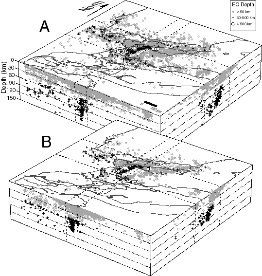
Figure 4.
Block diagrams showing seismicity in the Alboran region (same area as Figure 2). (a) Data compiled from local (CNCPRST) and global (ISC and NEIC) catalogs and relocations made by authors. NS and EW projections of seismicity located between the dashed lines are shown on block sides with x6 vertical exaggeration. Note the N-S line of intermediate depth seismicity that dips beneath the Alboran Sea from beneath city of Malaga (see Figure 2 for location) and the three deep earthquakes located beneath the central Betics. Scattered intermediate depth earthquakes are also located beneath the Gulf of Cadiz. The horizontal lines of seismicity at depths of 10 and 33 km are result of ISC and NEIC operators fixing the depth to obtain an epicentral location with limited data. Data shown formed the initial pool of local/regional data used for the velocity inversions. (b) Events relocated in derived 3-D velocity model after removal of poorly constrained events (failed criteria 1-8 shown in Table 3).