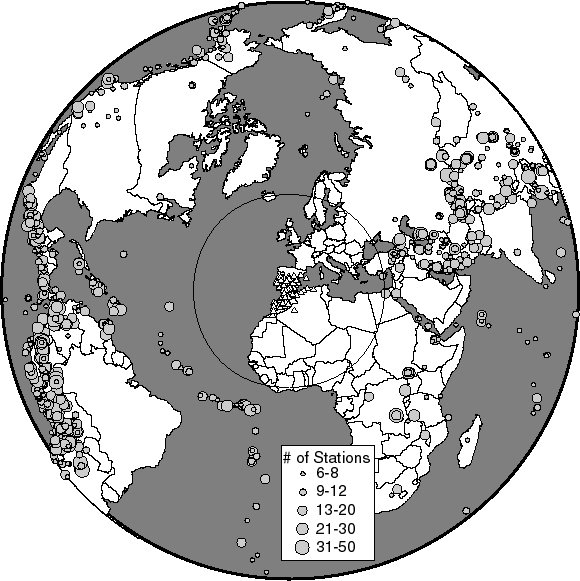
Figure 5.
Map showing the 1600 teleseismic earthquakes used for the velocity inversion. The size of the symbol marking each event indicates the number of stations in the Alboran region that recorded an impulsive arrival from this event. Note good E-W azimuth coverage. Illumination is limited from north and south, especially from the south. Circles mark 30 and 90 degrees from the center of the Alboran Sea.